Hood River Waterfront Park

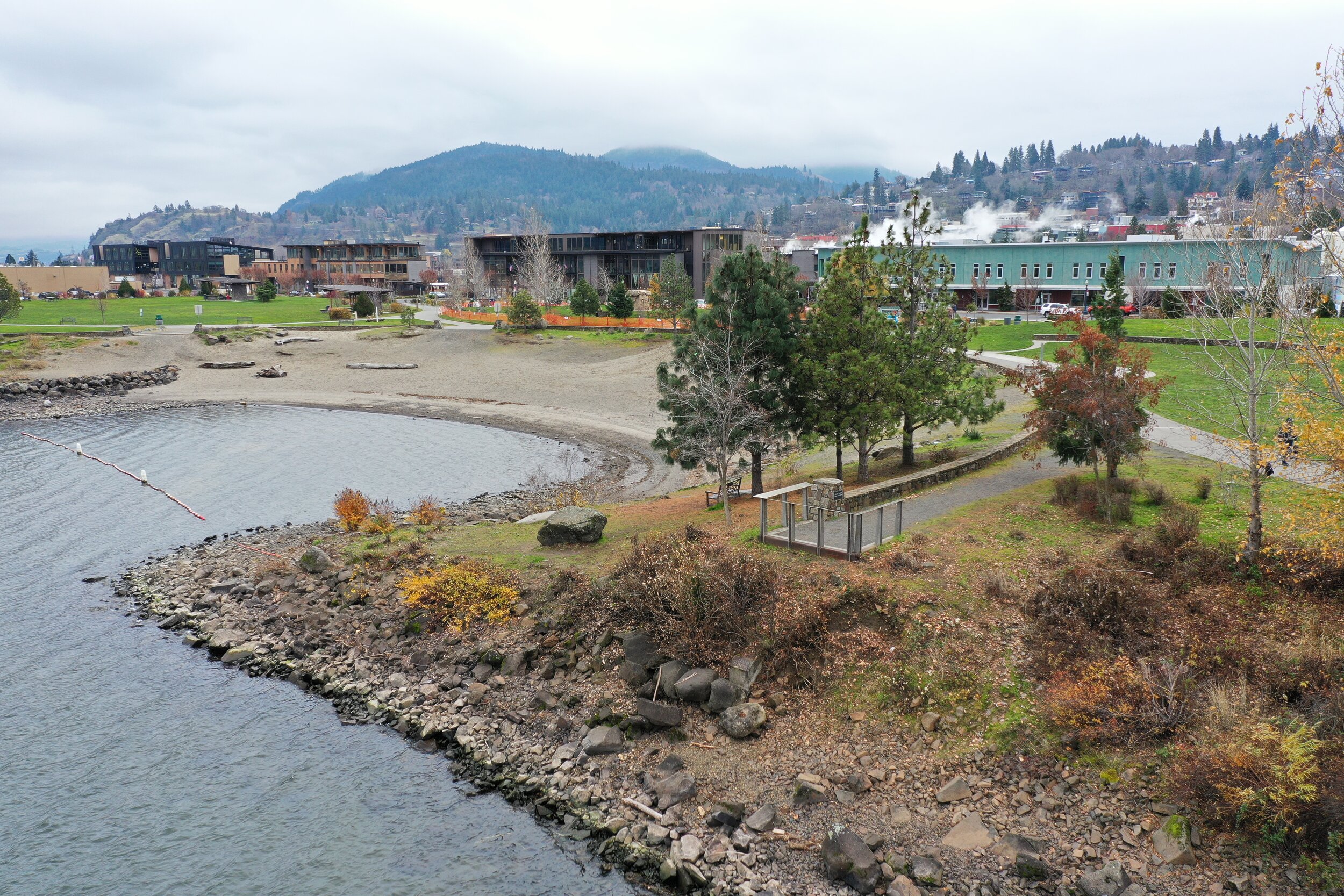
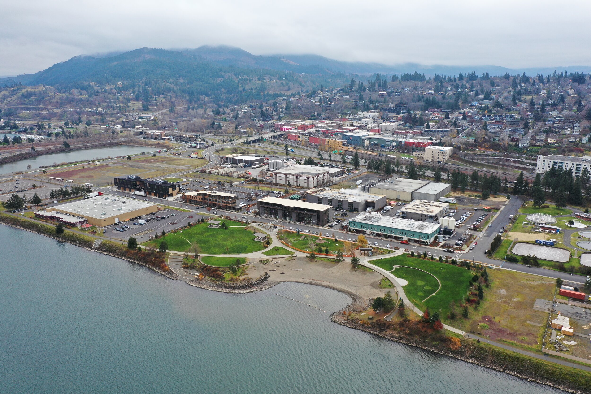
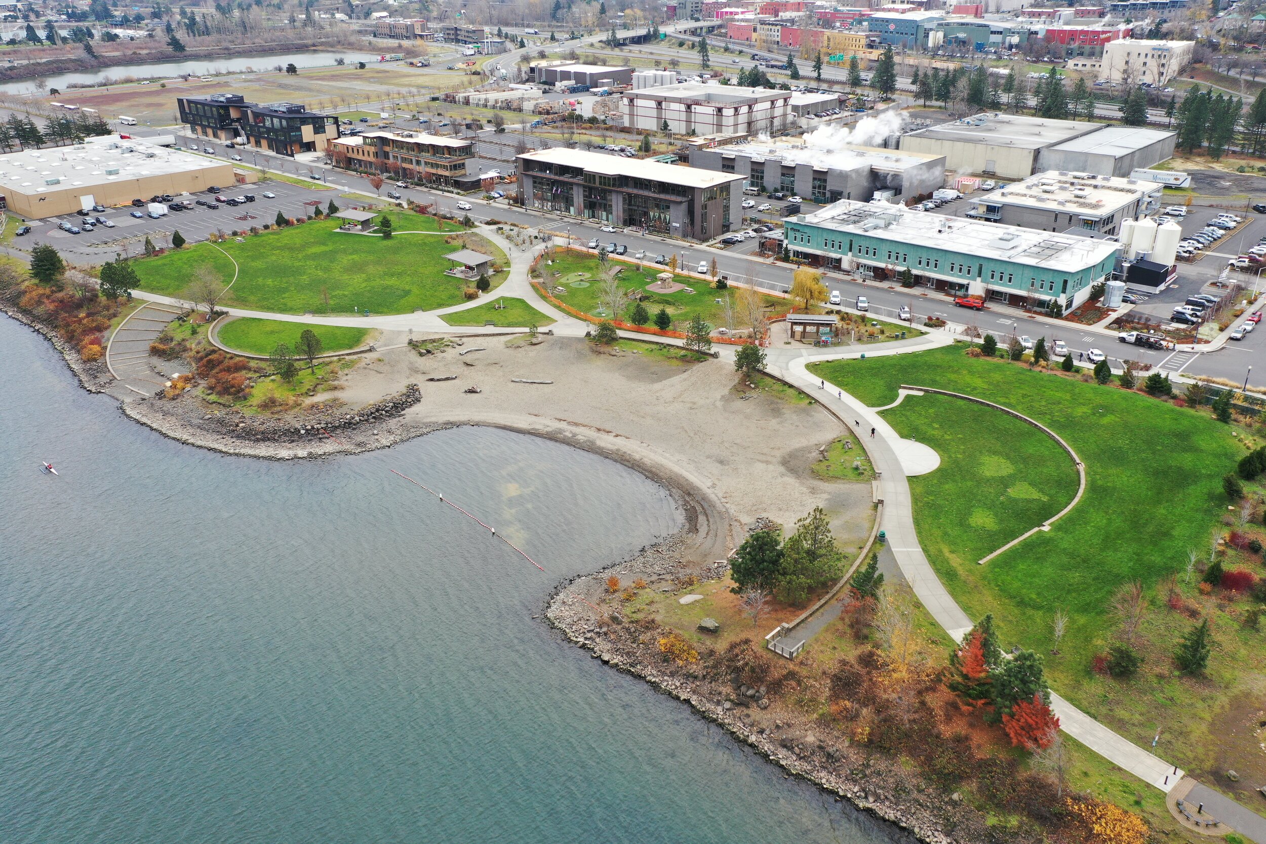
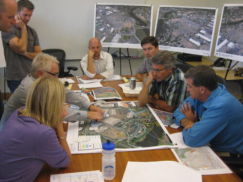
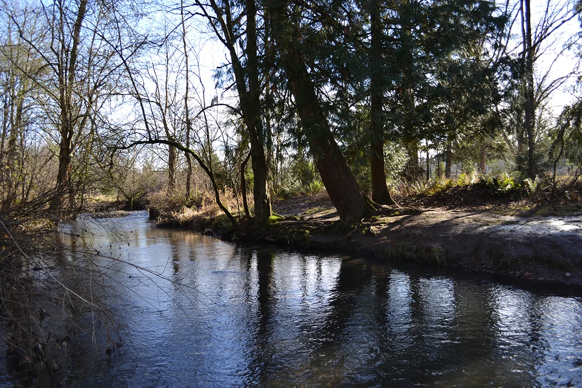
GreenWorks provided master planning and design services for the waterfront park in Hood River. The 6-acre park lies north of downtown between the Hood River Event Site and “The Hook” (a protected harbor for learning windsurfing) on property donated by the Port of Hood River. The Park helps connect the community to the Columbia River through a family-friendly public gathering space that accommodates a wide spectrum of uses. Our team went on to provide design services. Design features include beach and swimming access to the Columbia River, innovative children’s play facilities, and flexible areas for large community events and festivals. In addition, the park reclaims eight hundred feet of riverbank, laying back the slope and restoring the river’s edge with a wide variety of native riparian plants. The park sits north of commercial use sites to the south and has improved connectivity to the waterfront and increased economic development and commercial revitalization.

Hood-River-Waterfront_Park_Detail_Birdseye.JPG
HoodRiverWaterfrontPark_7_reduced.jpg

Hogan Butte Nature Park

Hogan_Butte_Viewpoint.JPG

Hogan Butte is a 43 acre park south of downtown Gresham and west of US 26. Hogan Butte has a rich natural history that is highly visible on-site and from the stunning 270 degree views from the top of the butte (with views of Mt. Hood, Mt. St. Helens, Mt. Adams, Mt. Rainier, the Columbia River Gorge and the City of Gresham). The position of the property and connections into the community provide unique opportunities for public access and education.

diagram showing elevation change with amenities like viewpoints, shelters, and a LABYRINTH


GreenWorks developed the Master Plan for the site, which recognized the unique value of the Hogan Butte site, both as a natural asset and community asset. The Master Plan meets community assessed needs and protects the natural environment. Program elements included: protecting and restoring natural resources, providing public access, appropriate infrastructure such as restrooms and parking, trails, signage and education. Hogan Butte has a rich natural history that is highly visible on-site and from the stunning 270 degree views from the top of the butte. The position of the property and connections into the community provide unique opportunities for public access and education.


“…a half-mile paved pathway snakes its way to the top. From the crest of the butte is a great view of Mount St. Helens, Mount Adams and Mount Hood, while the mountain finder situated there promises occasional peeks of Mt. Rainier and Mt. Jefferson too.” - The Oregonian

“At the top elevation of 930 feet, take in a stunning ‘Volcanic Viewpoint,’ a panoramic view of Mt. Hood, Mt. St. Helens, Mt. Adams, Mt. Rainier, the Columbia River Gorge and city of Gresham. Walk the half-mile paved interpretive loop trail and enjoy picnic areas with views of the forest. Educational signage is available in Russian and Spanish. An ADA-accessible parking lot has 20 spaces.” - Oregon Metro

Conceptual Visualizations

2006 quality visualization of pathway winding around a hill with picnic shelters and a meadow

George Rogers Park

GreenWorks prepared the Master Plan and design services for George Rogers Park located along the Willamette River in Lake Oswego. The project created visual and physical connections to the Willamette River and between elements within the park. Gateway enhancements, interpretive elements, and improved waterfront access were key design components. Creating a cohesive plan was paramount and included unifying the Barbecue Terrace with the Memorial Garden Terrace. The design also provided a soft canoe launch and waterfront access improvements. Boardwalks connected terraces and provided overlooks to the public beach area. The project removed existing pavings within the floodplain and provided mitigation plantings for all encroachments in the floodplain and greenway.

GeorgeRogers_reduced.jpg
GeorgeRogersPark_13_reduced.jpg
03_George_Rogers_Park_reduced.jpg
DSC_0152.JPG
MM_George Rogers Park.JPG
L1.2bsm.jpg
GeorgeRogerswalkreduced.jpg

Riverfront Connections: Lewis and Clark Festival Park

In The Dalles, East 1st Street and adjacent properties from Union Street to Laughlin Street posed unique development opportunities and design challenges within the heart of the community. The area had long been an unattractive, back alley view of the community from Interstate-84 and a neglected downtown street. The four-block long right-of-way was complicated by the adjacency of Union Pacific Railroad mainline tracks, unequal and narrow ROW widths, major elevation differences with adjacent properties, National Historic District requirements, and access issues. These challenges also offered a multitude of design opportunities for a distinctive streetscape and park redevelopment which ultimately has become a focal point for redevelopment and an invigorated downtown center. East 1st Street is now a gateway from the downtown to the Columbia Riverfront where vehicle, bicycle, and pedestrian traffic intermingles. GreenWorks and a team of engineers developed preliminary and final designs for East 1st Street streetscape, a pedestrian/bicycle under-crossing of the two mainline Union Pacific Railroad tracks, a pedestrian plaza at Washington Street, a cruise ship and public dock area connecting the City of The Dalles to the Historic Columbia River, and the iconic Lewis and Clark Festival Park. The project has served to enhance community identity and encourage economic development.

TheDalles_Riverfront_Connections.jpg
Lewis&Clark_Pavilion_sm.jpg
Lewis&Clark Pavilion-7_sm.jpg
The_Dalles_Lewis_Clark_Festival_Park_DSC2307_sm.jpg

Headwaters at Tryon Creek

GreenWorks provided landscape architecture services in master planning a new 2.8 acre mixed residential development near the headwaters of Tryon Creek. The project includes a variety of residential types including elderly housing, town homes, and a Portland Development Commission (PDC) built low-income apartment building. All of the new residential developments, along with an existing apartment building, were designed to be integrated with the daylighting of a tributary of Tryon Creek. The development was coordinated with many local agencies (PDC, Portland Department of Transportation, Portland Parks and Recreation Bureau, and Bureau of Environmental Services) to extend the daylighting project from the headwaters of the tributary in a park adjacent to the site, through the site and adjacent neighborhood to Tryon Creek. The goal of the developer and the design team was to incorporate the buildings, parking, plazas, bridges, and other site elements into a cohesive sustainable site development that takes full advantage of this daylighting opportunity. GreenWorks services include schematic design, design development, construction documentation, and services during construction. This project is certified LEED Silver.

Headwaters at Tryon Creek_FrontPageWeb_reduced.jpg
Headwaters- Tryon Creek swale1.jpg

Mirror Pond Visioning Project

GreenWorks consulted with Bend Parks and Recreation District on alternatives to provide four different solutions for the community to consider for the iconic Mirror Pond on the Deschutes River in Bend, Oregon. Each option, ranging from taking out a dam to dredging or something in between, will illustrate the visual impact, cost estimates, regulatory requirements, challenges and opportunities.

MirrorPondGIFreduced.gif

Cape Horn Trail

Cape Horn Trail is an eight-mile trail in Skamania County located twenty-six miles east of Vancouver, WA. GreenWorks is providing services for the US Forest Service for improvements to an existing trail, which has two at grade crossings where hikers and horseback riders traverse the heavily traveled State Route 14. To improve safety for trail users, the Forest Service and WSDOT are constructing pedestrian underpass tunnels at these two crossings. GreenWorks developed schematic designs for the tunnel entrances and provided construction design drawings for the tunnel fascias, which include stonewall construction, custom metal guardrail fencing design and planting design around the entrances. The design of the tunnel fascias incorporate locally quarried Columbia River Basalt to form walls that echo other examples of historic basalt stone work in the Columbia Gorge.

Cape-horn-tunnel-rendering-no-text_reduced.jpg
DSC_0767-edited_reduced.jpg

Simpson Pavilion

drone photo of Simpson pavillion during sunset, roundabout and cascade mountains in view

As a sub to Opsis, GreenWorks provided services to Bend Parks and Recreation District (BPRD) for the conversion of a former 3.25 acre parking lot into a new open-air pavilion that will house an Olympic-standard ice rink in the winter and numerous activities such as tennis, basketball, and concerts in the summer.

The site was redeveloped with an iconic pavilion structure, support facilities, a courtyard green, and flexible lawn spaces adjacent to the pavilion for community events.

Per BPRD’s direction, several Low Impact Development (LID) techniques were incorporated. For stormwater management, LID alternatives such as infiltration swales and galleries throughout the site for stormwater collection were provided. Other LID options include providing ample bicycle access, bicycle parking, and pedestrian connectivity. The project was completed in 2015.

hand drawn diagram of master plan for simpson pavilion with circulation patterns
people surround a map in an office with aerial photos behind them
simpson pavillion visualization with car and people passing around it

Mt. Scott Creek Restoration

GreenWorks and Inter-Fluve recently helped Clackamas County Water Environment Services prepare an application for METRO’s Nature in Neighborhoods Capital Grants Program. This lower section of Mt. Scott Creek has been characterized as a high-priority for instream restoration of rearing habitat for Coho and Steelhead Trout. The requested funds would finance enhancement the installation of large woody debris within the creek channel to increase ecological functions and diversity in the creek for fish habitat. The project also included enhancement of the confluence of Mt. Scott Creek and Camas Creek and installation of two public education overlooks to increase watershed health awareness and provide community stewardship.

Photo May 11, 11 33 03 AM (2).jpg
Photo May 11, 11 29 41 AM (1).jpg
Photo May 11, 11 41 00 AM (1).jpg
mtscottcreek_website_062118_02.jpg
mtscottcreek_website_062118_01.jpg
10231_mt. scott Confluence_Overlook Concepts_Page_2.jpg

Clackamas HS Stormwater Retrofit

Clackamas County Water Environment Services (WES) hired GreenWorks to prepare a master plan for Clackamas High School that identifies and prioritizes potential stormwater low impact development retrofit projects.  The second phase of the project will be to design and build one or more projects (such as rain gardens, green roofs, structural soils, etc.) that can visibly demonstrate the benefits of low impact development practices to students, teachers, parents and the general public.  The project(s) are also intended to reduce the negative impacts of stormwater runoff on local streams from the substantial impervious area at the High School.   As part of the master planning process, we interacted with high school science classes, telling students about Low Impact Development (LID) and gathering their input on project options. When a project(s) is selected for design and implementation, students will, as possible, help with planting and long-term care.

CHS_LID_Master_Plan_1.jpg
CHS_LID_Master_Plan_2.jpg

Tigard River Terrace & Design Guidelines

GreenWorks assisted the City of Tigard to develop a vision for the new main street in the River Terrace community. The new center spine of the community, which is parallel to and east of Roy Rogers Road, is envisioned as a boulevard that seamlessly integrates the River Terrace Trail into its design, provides safe and comfortable multi-modal travel options, and includes high-quality pedestrian-scale design treatments that define it as the neighborhood’s signature street. In order to successfully balance mobility with safety and comfort, it is important to control speeds along this street through a variety of design approaches that facilitate through travel but discourage cut-through traffic.

Residential parking and access needs were carefully considered during the design process, including, at a minimum, an evaluation of how any proposed parking and access would impact trail users, vehicular travel speeds and volumes, and subdivision design (e.g. block length and orientation of dwelling units). The overall design of the street will serve to enhance the neighborhood and the adjacent residences without being a barrier to those who will live on either side of it in the future.

River_Terrace.jpg

St. Helens US 30 Corridor Plan

This large-scale planning project involves planning for both a state highway and main street urban streetscape. The goal of the Highway 30 project is to provide safe, convenient access to local businesses along the highway, while balancing that with state goals for traffic mobility. GreenWorks is providing design and planning overview for this project.

US 30 StHelens_Page_13.jpg