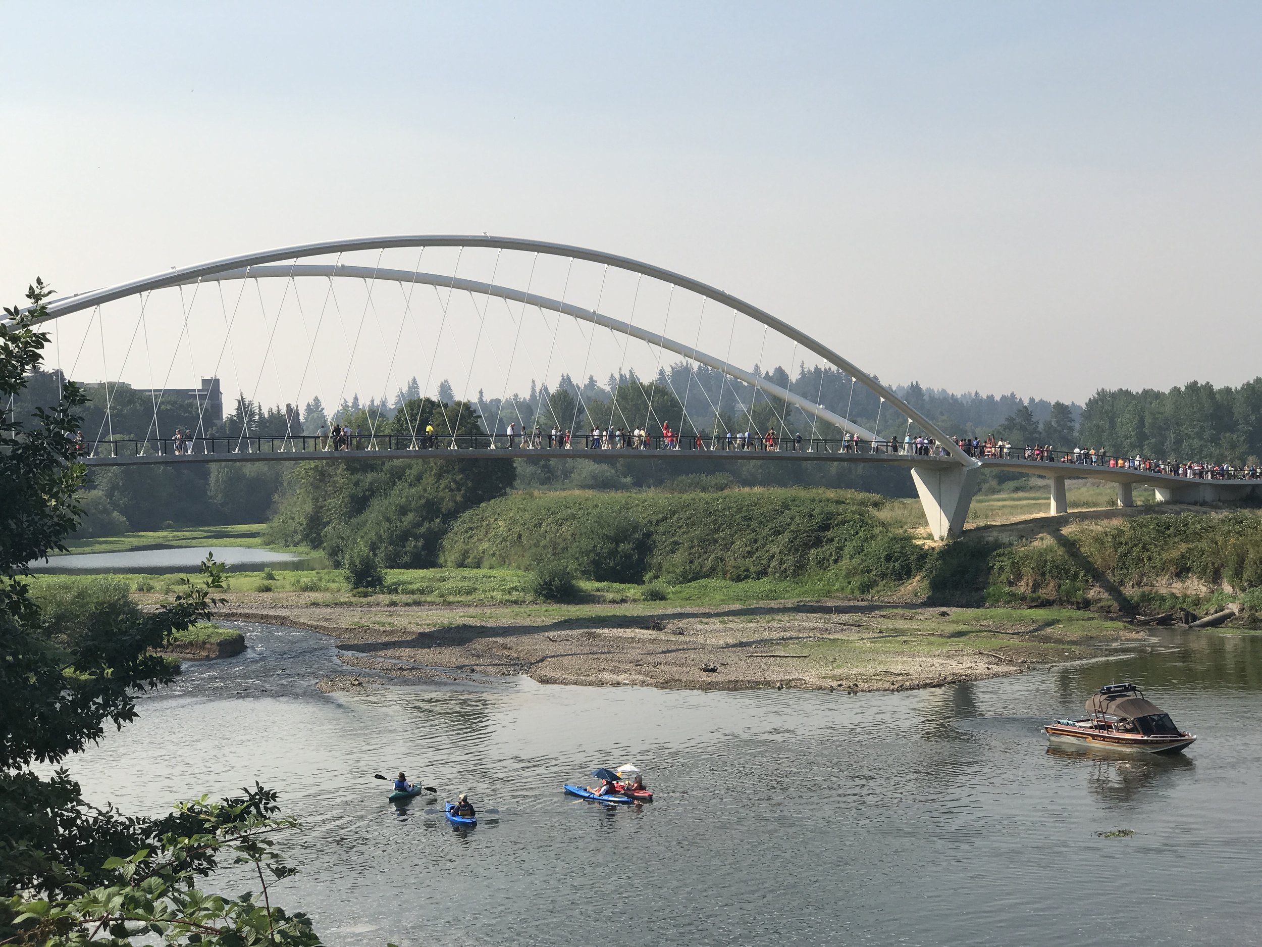
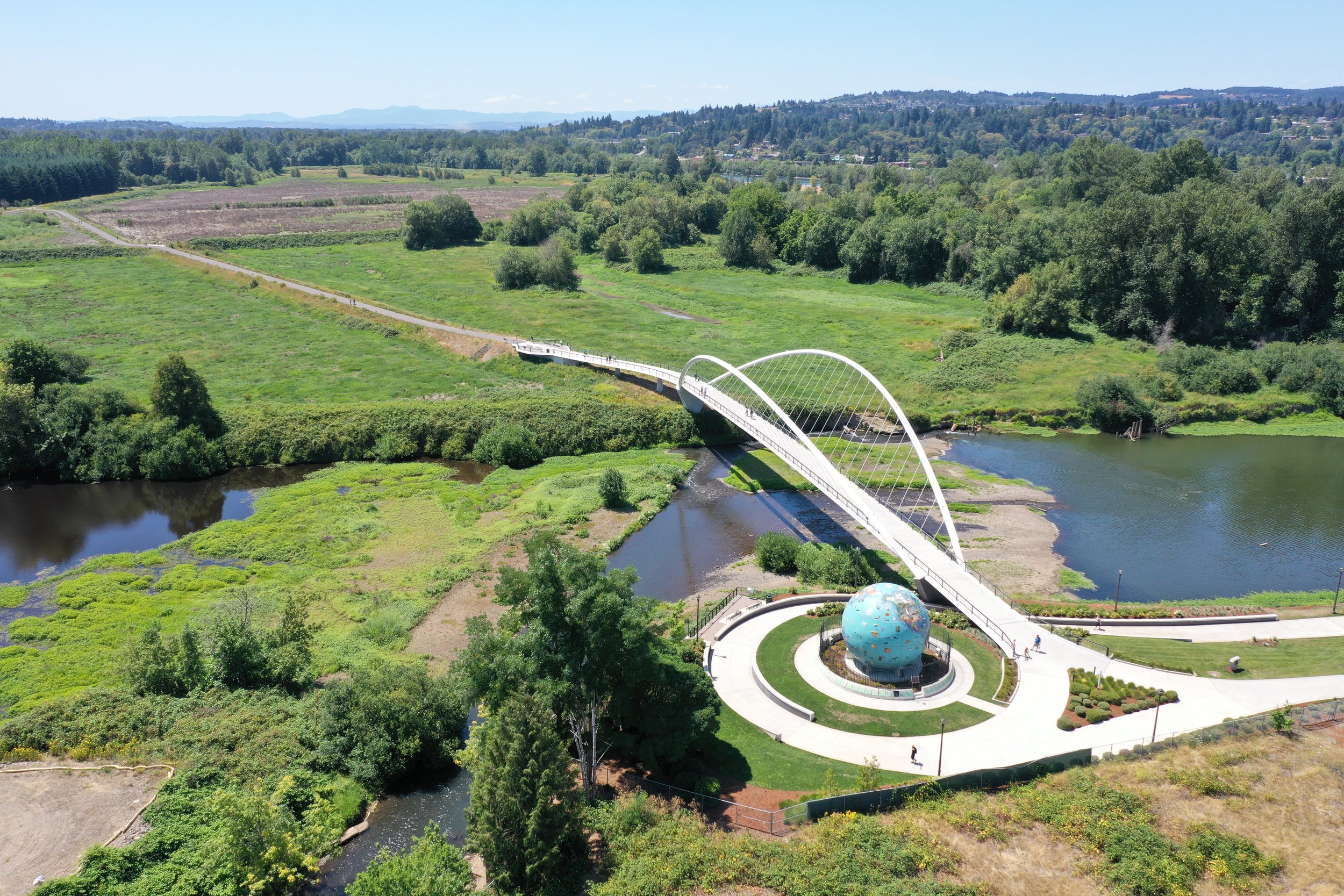
Minto Island Bicycle & Pedestrian Bridge

Minto_Island_Suspension_Bridge_Trail_Connections_Salem.JPG

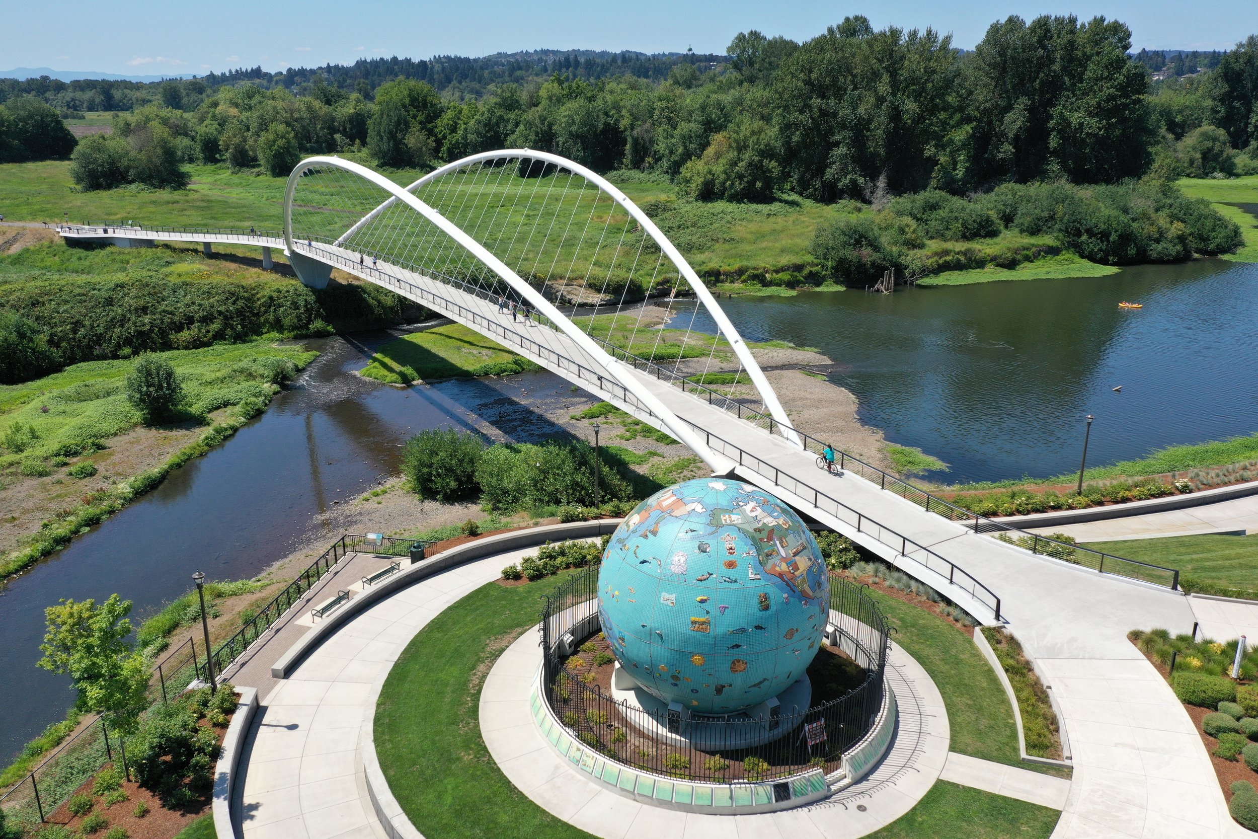
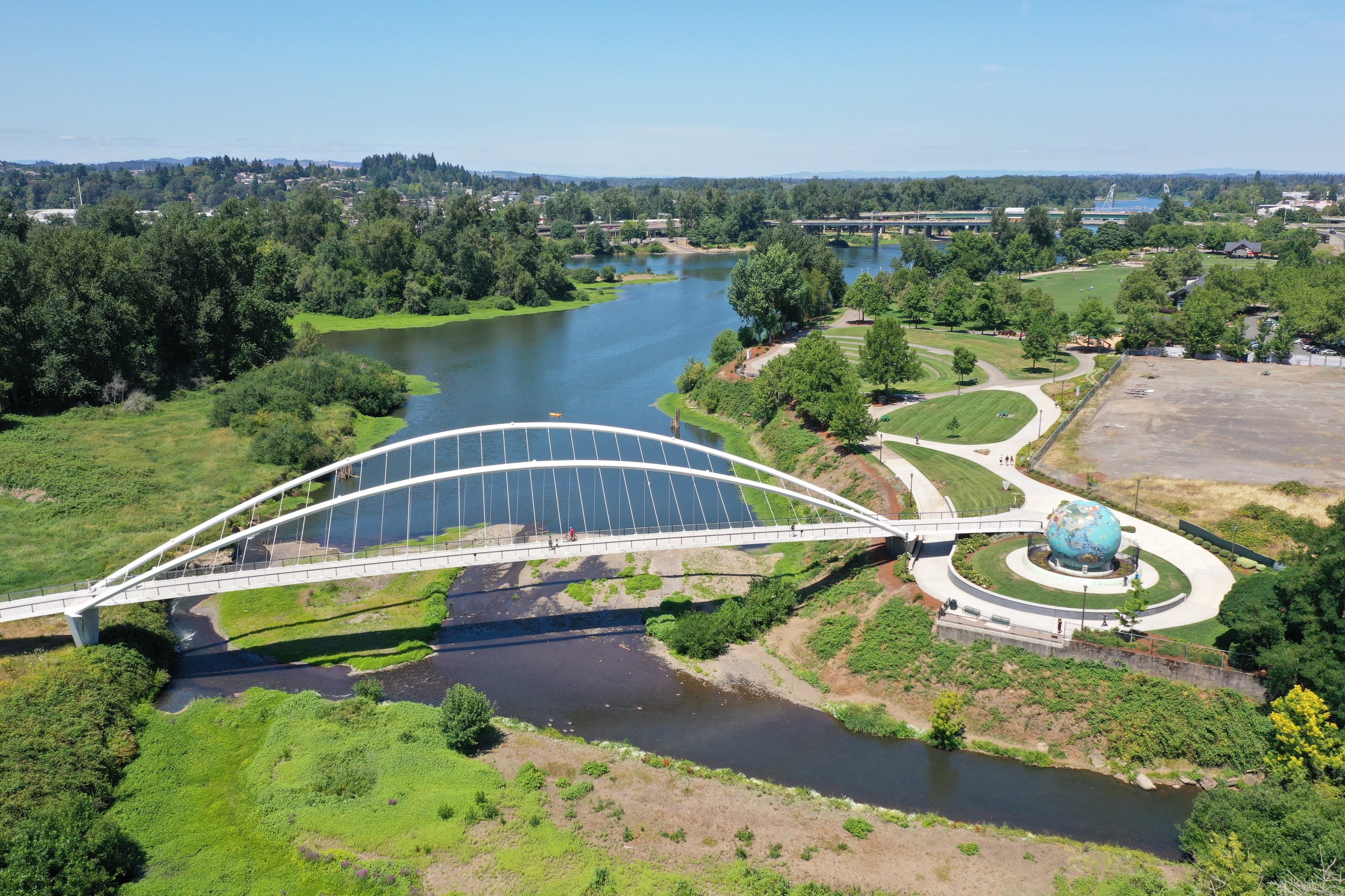
The City of Salem and Salem's Urban Renewal Agency have been working toward a community vision of connecting three major urban parks and more than twenty miles of trails via two pedestrian bridges over the Willamette River.

Person stands above us on a suspension bridge, the span shooting off into the distance on a sunny day

“The bridge and trail and efforts to pursue funding for the acquisition of Minto Island are consistent with the Willamette River Legacy Program. The program aims to improve river access, expand parks in the Willamette Greenway, and build upon efforts to enhance this former industrial site for passive recreation, wildlife viewing, and habitat restoration.” - The City of Salem

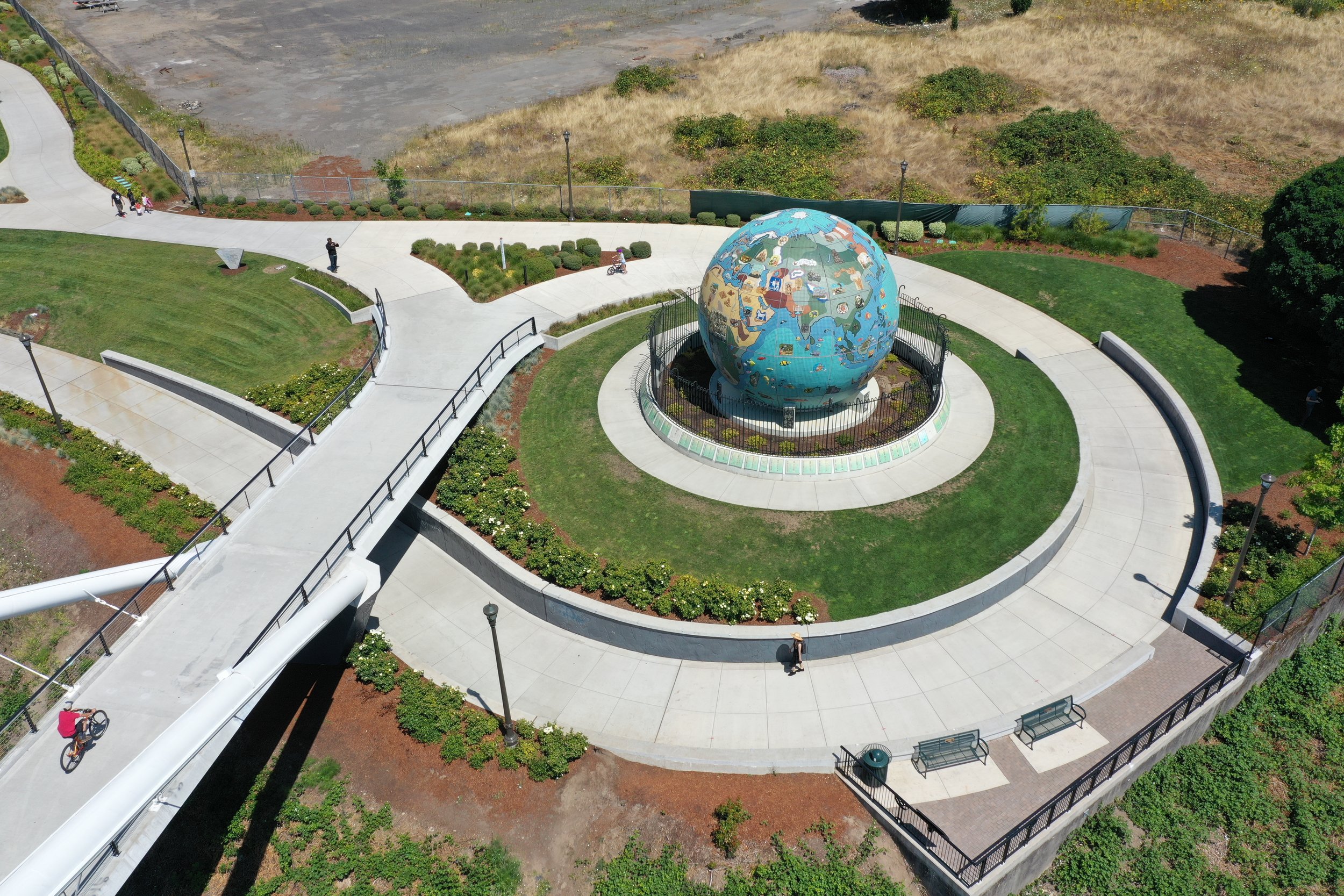
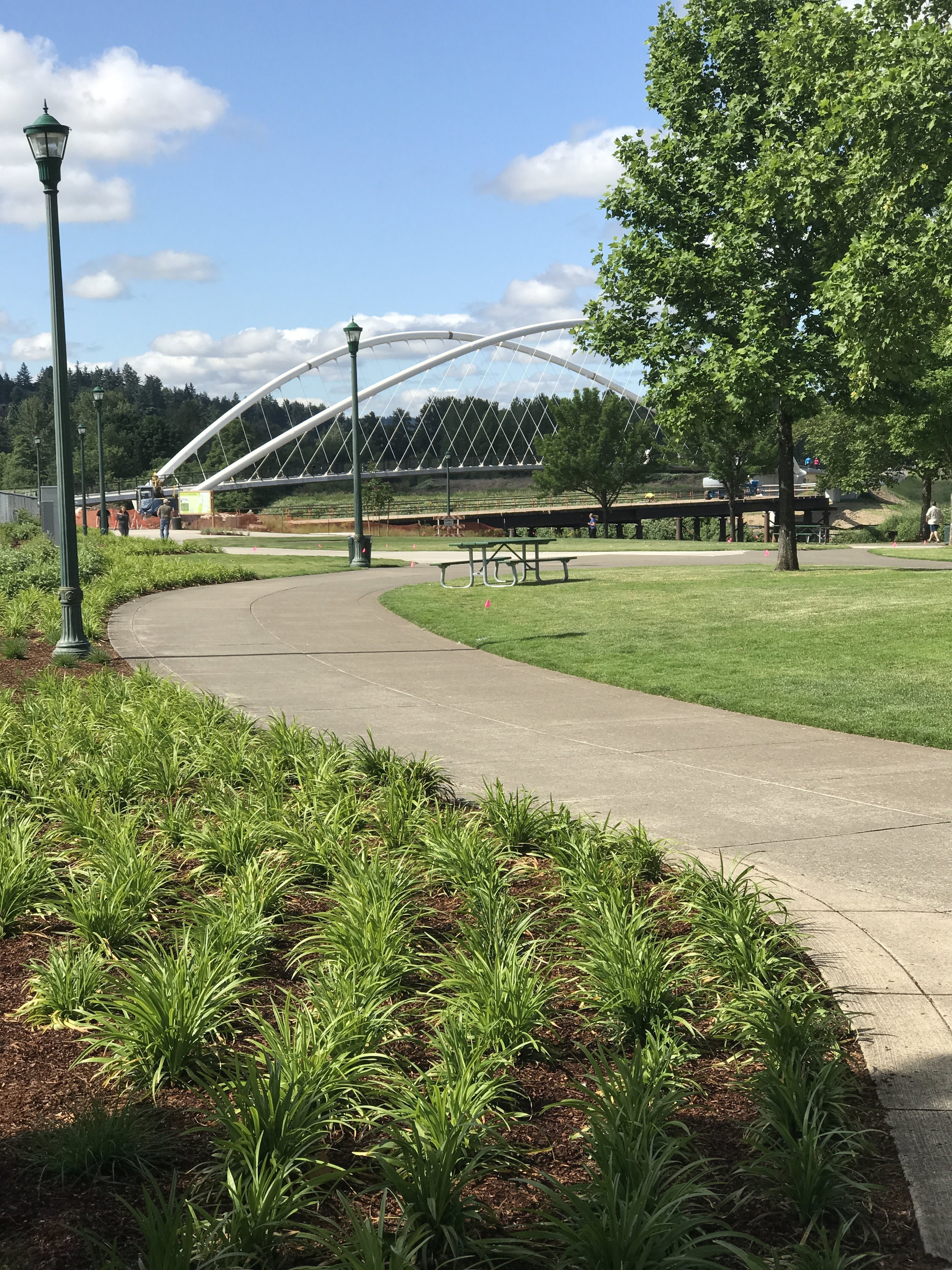
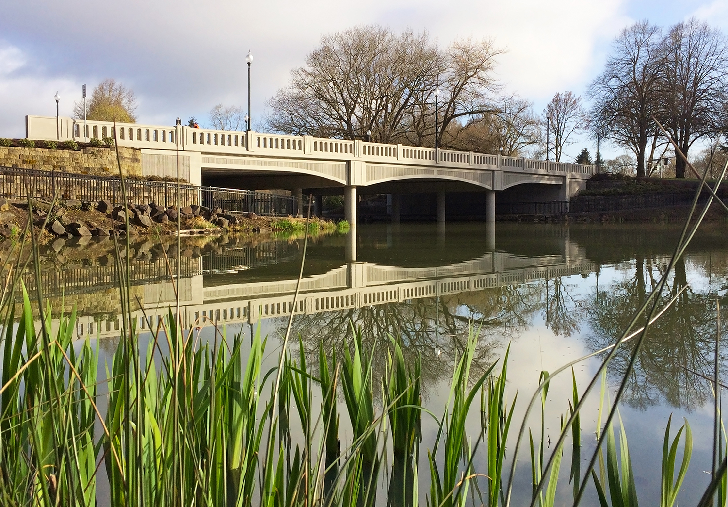
Part of this goal was realized with the renovation of the historic Union Street Railroad Bridge connecting West Salem’s Wallace Marine Park with downtown’s Riverfront Park. Completion of the Minto Island Bicycle and Pedestrian Bridge and adjoining multi-modal trail is the last critical link. For the design and permitting, the City of Salem hired OBEC Consulting Engineers with GreenWorks to complete the bridge design, perform needed studies, and apply for permits.

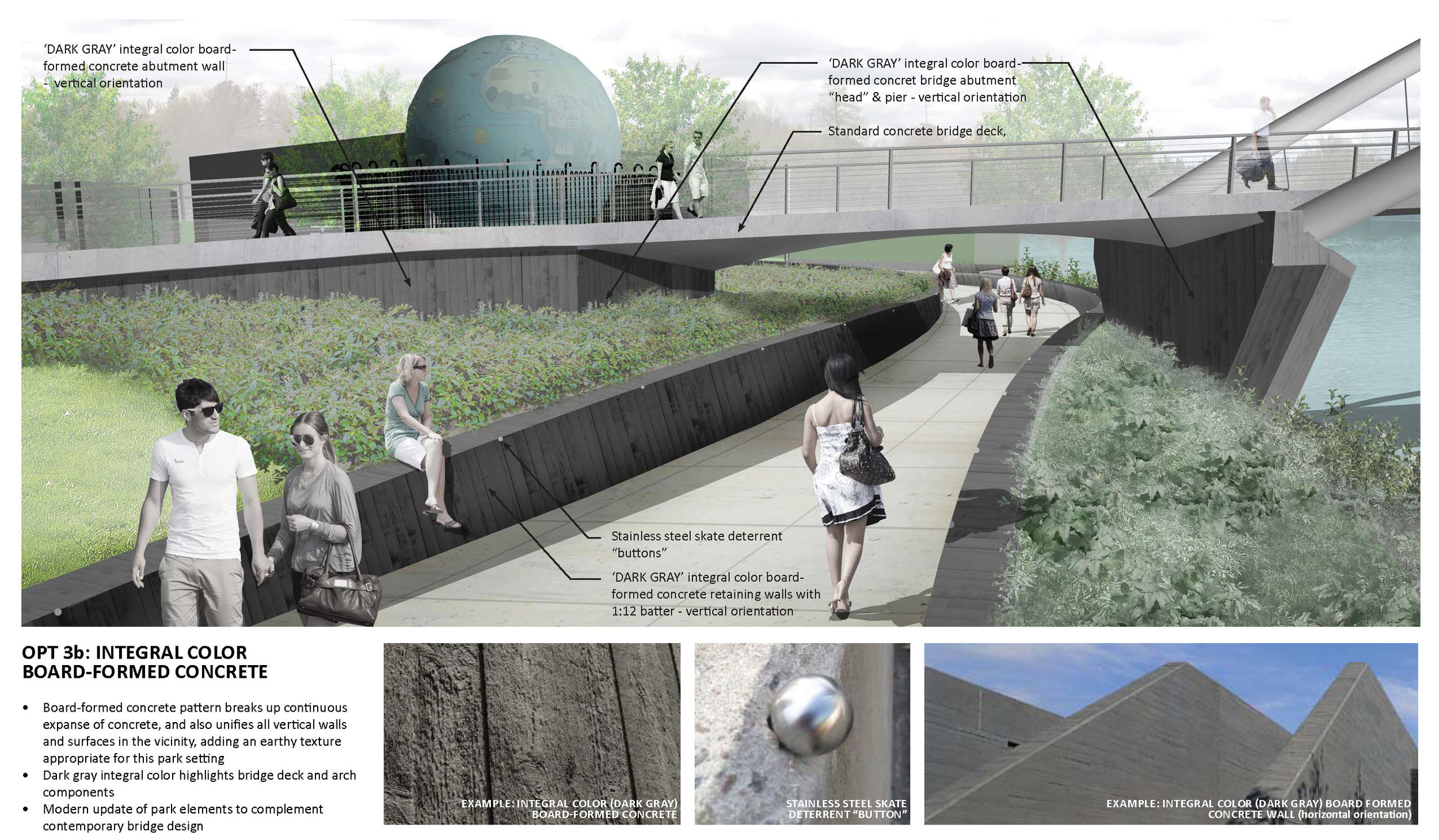
The detailed design work includes services that integrate context appropriate safe infrastructure for pedestrians, bicycles, and other trail users.

Conceptual Visualizations by GreenWorks

Oregon City OR 213 Redland Road

Oregon_City_OR_213_Redland_Road_Roundabout.jpg

GreenWorks provided planting and irrigation design services for this project known as the Jughandle Project in Oregon City, Oregon. GreenWorks worked closely with the City to develop planting designs for the following:
• A distinctive new landscape gateway feature complementing a rehabilitated Oregon City sign at Prairie Schooner Way, featuring a striking planting palette of native and low-water adaptive plants.
• Pedestrian-friendly streetscapes and green street stormwater facilities along Washington Street, including a roundabout intersection at Clackamas River Drive.
• Private property frontage improvements with strategic vegetative screening at key locations.
In addition, GW developed a long-term planting approach for the 6-acre floodplain mitigation site, including almost 4,300 native deciduous and coniferous trees and 2,400 native shrubs. One significant aspect is the sheer scale of Jughandle Project. In addition to the large number of trees and shrubs planted at the floodplain mitigation site, the City planted 82 new street trees, over 500 landscape trees, and more than 25,000 shrubs and groundcover plants. This creates a substantial positive visual impact on this gateway into Oregon City.
This project received the American Public Works Association (APWA) Project of the Year Award in 2013 ($25 to $75 Million Category).


redlandroad_website_062118_01.jpg
or213-redland-road.jpg

Bend Whitewater Park Colorado Avenue Pedestrian Bridge

people cross pedestrian bridge over deschutes river at sunset

On the Deschutes River, the Colorado Avenue Dam creates an impoundment that was once used to support lumber mill operations. The dam currently maintains water surface elevations upstream in the Mill District area, and is located in an area of the river heavily used during the summer months by people on inner-tubes and other inflatable craft that require little skill to operate. The current dam and footbridge configuration blocks downstream passage and requires all river users to exit the river and portage around the impediment. This requirement to portage around the dam exposes a high number of low-skilled users to the potential of being swept into the dam which creates a sieve-like, pinning hazard.

Bend_Whitewater_Park_River_Recreation.jpg

Teamed with OTAK, Pacific Habitat Resources, and River Restoration, GreenWorks provided a safe passage over the existing Colorado Dam for many types of river users including inflatable craft, and whitewater play features for hard shell boats including kayaks and canoes.

In addition to the in-water recreational components, the design proposes increased habitat diversity along the reach by incorporating fish passage and on-bank habitat restoration, design improvements to McKay Park, and removal of the existing pedestrian bridge and replacement with a new, higher, pedestrian bridge.

ColoradoPaddleTrail_BridgeRailingConcept2.jpg
Bend_pedestrian_bridge_whitewater_park_sunset.JPG

Tualatin Nyberg Interchange (Interstate 5)

GreenWorks created a master plan for the interior Interstate 5 corridor through the City of Tualatin. The first phase of this involved a comprehensive opportunities and constraints analysis, that identified target areas and potential scope of improvements throughout the corridor. This led to the design of a master plan that provides the conceptual view of long-term and short-term landscape improvements, as well as potential costs. The master plan was approved by Tualatin, as well as regional ODOT staff for compliance to recommended plant species and overall maintenance regimes. The master plan provides guidance for future landscape improvements, opportunities for public-private partnerships, and overall consistency of subsequent projects.

The second phase involves the development of a more detailed design of landscape improvements for the Nyberg Road Interchange (phase one). This expansive interchange is currently underutilized and offers the opportunity to become the visible gateway to the City of Tualatin. Design challenges involved working with ODOT for maintenance access and planting apporpriateness made easy through pre-review of the master plan in the first project phase. Since the majority of users for the interchange are in fast traveling vehicles, we developed 3D modeling and photomontage design solutions to represent the user experience at speed. This greatly improved the overall communication of design intent. After developing and refining a number of possible solutions with the project team, including Tualatin and review by ODOT, a preferred alternative was created, and construction documents were prepared.

_DSC5334_reduced.jpg
Nyberg_Birdseye_reduced.jpg
Nyberg2.jpg
Nyberg3.jpg

Washington Way Bridge

The Washington Way Bridge replacement project replaced an existing 66 foot wide, five-lane, timber-structure bridge that spans 160 feet, crossing over Lake Sacajawea in Longview’s historic Lake Sacajawea Park. GreenWorks worked with a team of engineers to provide architectural design input for a new concrete bridge that complements the historic character of the park and meets better safety needs with wider sidewalks and enhanced lighting. GreenWorks also provided architectural renderings of the proposed bridge design and additional graphic support for two public open houses to solicit public input. Architectural elements considered in the design of the bridge included railing design, layout of ornamental lighting, bridge materials and finishes, and bridge span and pier types. Planting design of the landscape adjacent to the new bridge included plant and tree species consistent within the context of Lake Sacajawea Park.

IMG_1995_reduced.jpg
Washington-Way-Bridge-Sequence_reduced.jpg

Cape Horn Trail

Cape Horn Trail is an eight-mile trail in Skamania County located twenty-six miles east of Vancouver, WA. GreenWorks is providing services for the US Forest Service for improvements to an existing trail, which has two at grade crossings where hikers and horseback riders traverse the heavily traveled State Route 14. To improve safety for trail users, the Forest Service and WSDOT are constructing pedestrian underpass tunnels at these two crossings. GreenWorks developed schematic designs for the tunnel entrances and provided construction design drawings for the tunnel fascias, which include stonewall construction, custom metal guardrail fencing design and planting design around the entrances. The design of the tunnel fascias incorporate locally quarried Columbia River Basalt to form walls that echo other examples of historic basalt stone work in the Columbia Gorge.

Cape-horn-tunnel-rendering-no-text_reduced.jpg
DSC_0767-edited_reduced.jpg